

Guarapiranga Park

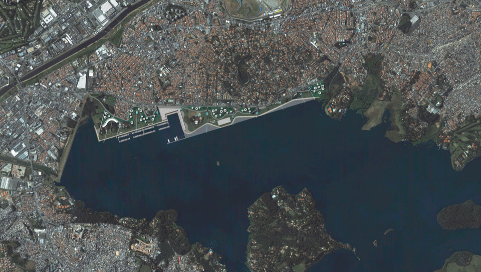
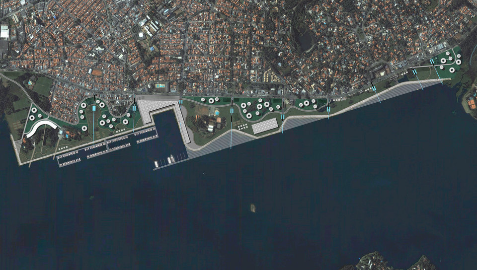
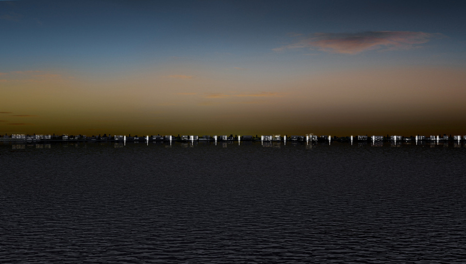
The urbanization of part of Robert Kennedy Avenue, located by Guarapiranga dam, integrates a project better defined as Touristic Contour of Guarapiranga Dam. The proposed intervention corresponds to 8% of the total dam bank. Within those limits, the objective of the project retakes a tendency that consists in acknowledging and displaying a fluvial front, as a privilege matter, and with great potential as to reestablish urban identity values within the metropolitan scale. The intent of the proposal is to define only one pondered prompt intervention, instead of a model to be extended along the entire bank.
In many Brazilian cities, just as in international ones, fluvial fronts have been delegated to disqualified areas, being consequently invaded by informal housings on a regular basis, therefore aggravating the creation of urban barriers of difficult transposition. Yet, the urban cultural process itself has started, internationally, to acknowledge the importance of urban fronts along fluvial borders. Hundreds of examples arise from this scenario, instigating urban planners as well as public authorities to adopt a new approach to these fronts, always revealed as highly accelerated motors of development. Thus the project intention is to reacquire this tendency, summarized as “privilege lines” in the acknowledgement and representation of fluvial fronts.
The total intervention extension consists of 4,5 km and it covers an approximate area of 136 ha, in which the development of new relevant social and economic value activities have been estimated, and which may become one of the most important urban interventions in Sao Paulo city. The project contributes to the configuration of a particular image toward the construction enterprise and the city itself. This “motor of development” will generate new competitive factors as economic space fulfilling its social integration role.
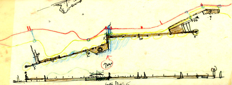
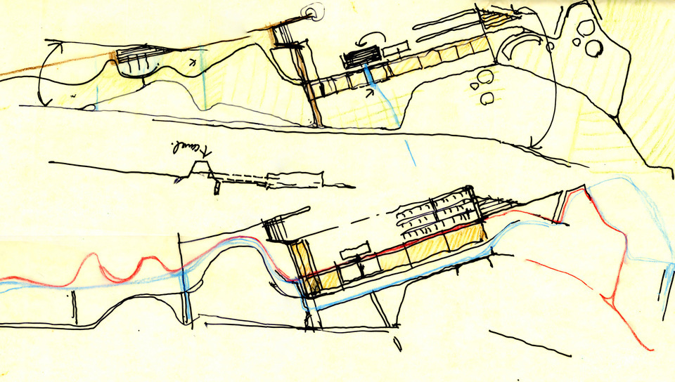
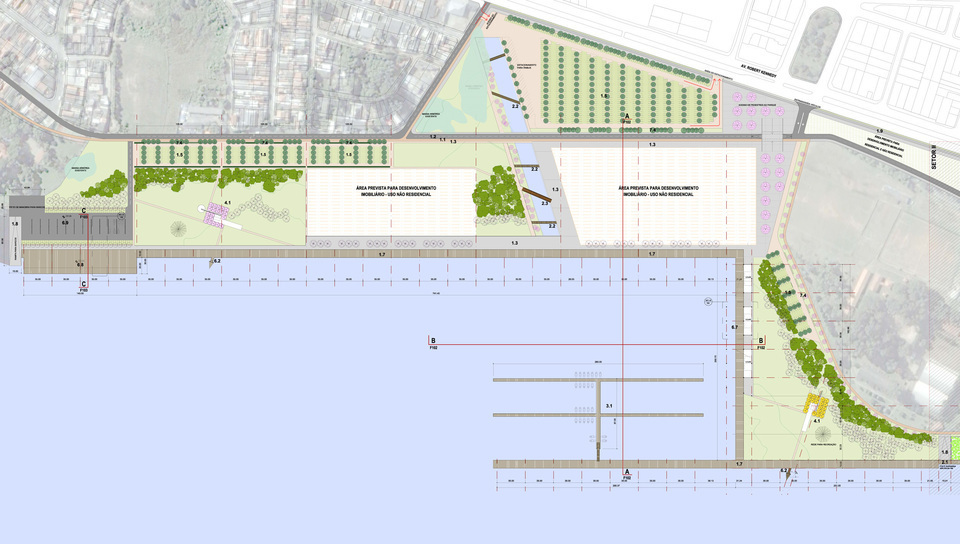
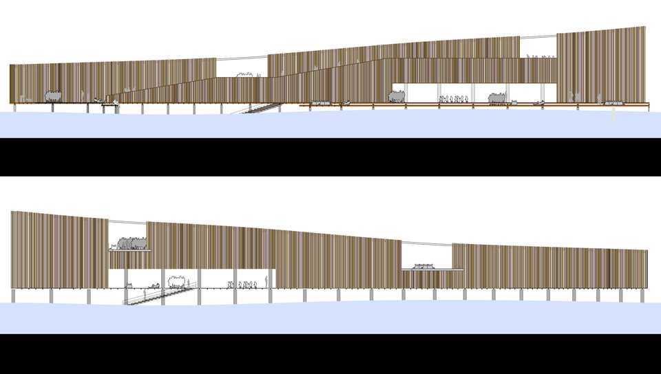
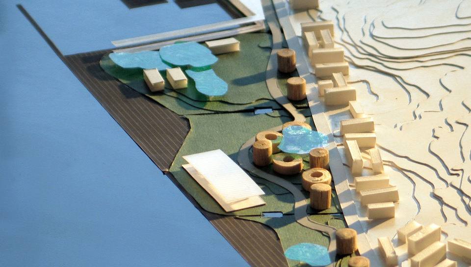
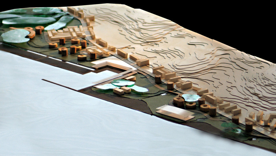
The project is based on establishing acquired-ground area over the dam bank area, already silted from the bank formal consolidation, defined by a contention line extending between the entire park interface and the dam.
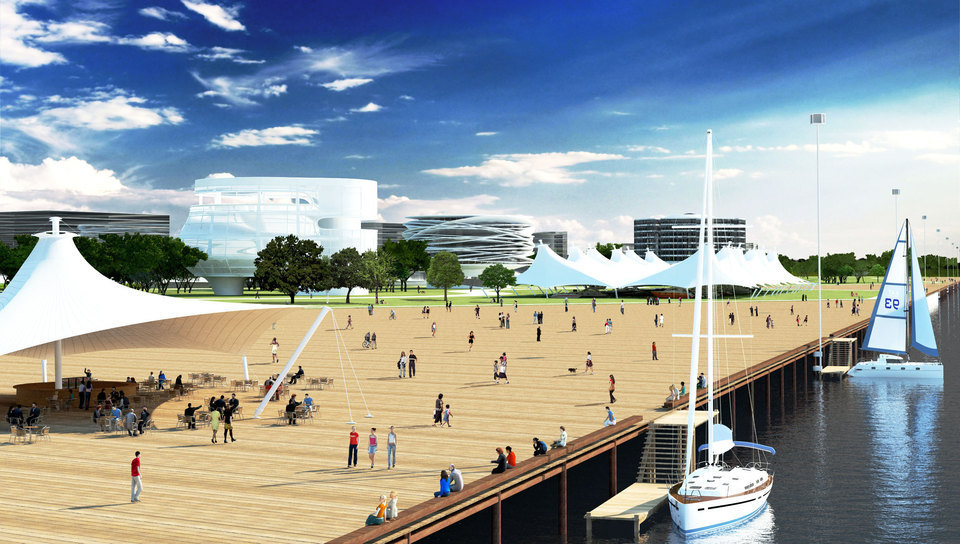
Over this interface structure leans a wooden deck with the purpose of a wide public promenade along the park. A new territory strip expands from this deck allowing the development of various activities, both of public and private purposes.
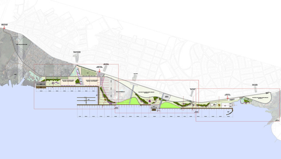
The park territory strip is subdivided into three sectors, as illustrate below:
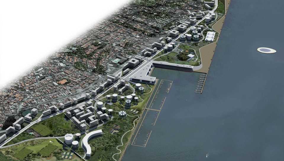
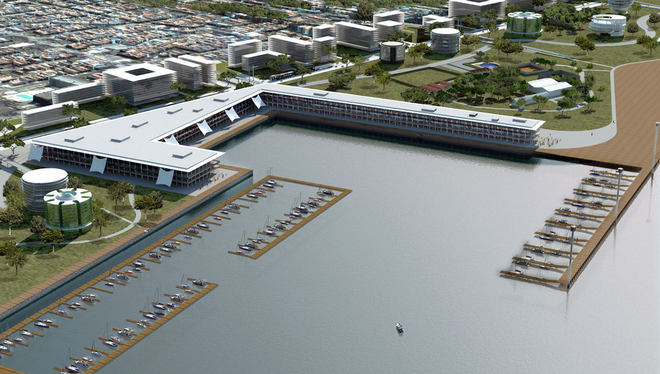
Sector I – It concentrates the anchor activities of the intervention: Public Marine, commercial center comprising a nautical mall and kiosks, and a place designated for exhibitions and fairs. The biggest parking areas of the park are also concentrated in this sector, together with a 200-boat-capacity floating pier.
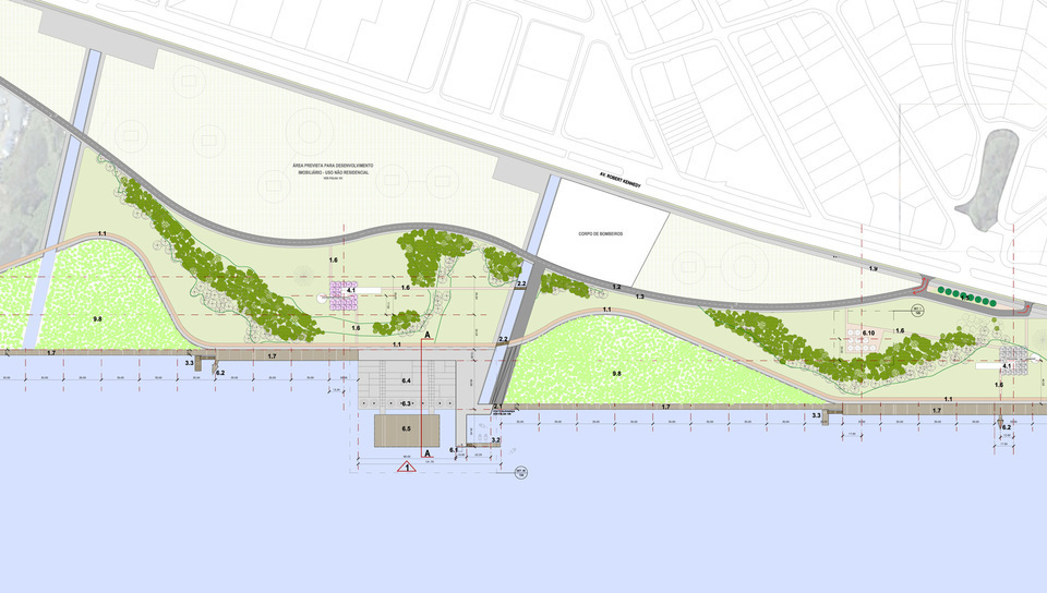
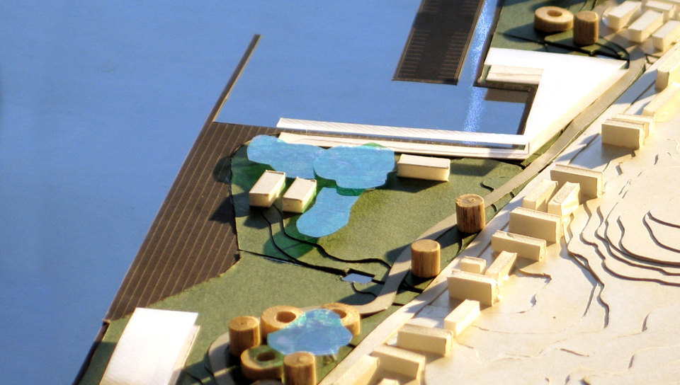
Sector II – It is characterized by a wide performance stage connected to a concrete urban beach and water fountains.
Sector III – It assembles leisure and sporting equipment, such as the soccer field, polysport complexes and tennis court, skateboarding rinks and the big swimming pool – aquatic recreational structure introduced into the dam and composed of springboards and deck.
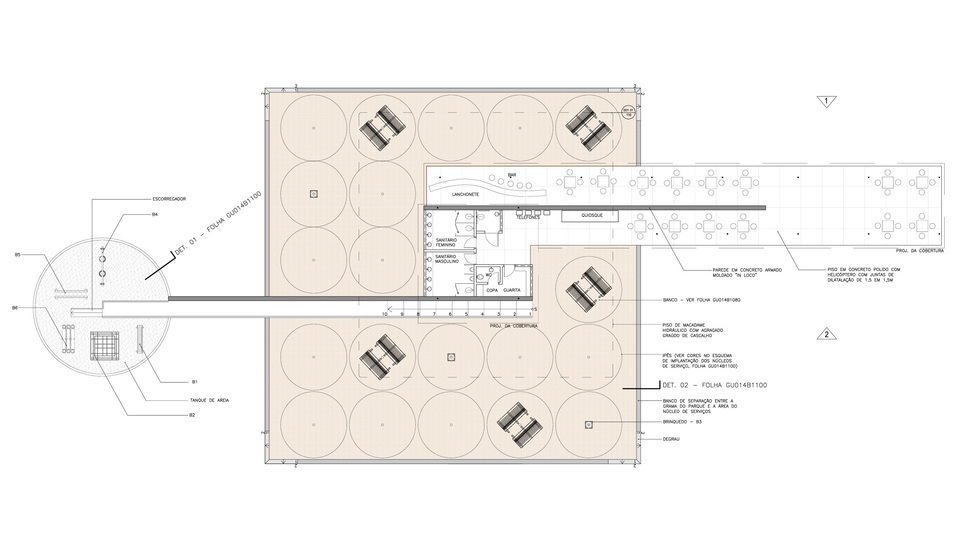
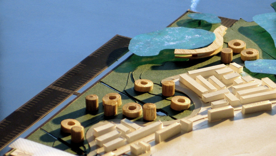
The service centers consist of structures that concentrates most of the facilities, such as snack bars, sanitary facilities, payphones, playground and security facilities. They are distributed along the park and are indentified by their distinguished vegetation.
Environmental protection areas are located at the edges, therefore demarcating the north-south limits of the park.
Along Robert Kennedy avenue strip, on a consolidated middle-income residential occupancy, an over-time transformation is suggested through the settlement of new indices related to the parceling, use and occupancy of the land, all of them complying with the urban proposal settled toward the project total area.
With regard to the remaining areas along Robert Kennedy avenue strip, it has been suggest the occupancy of the area by residential, commercial and service intend buildings, setting the area in pursuance of a future real estate development, which may result in both conservation and valorization of part of the territory.
The occupancy proposed toward this line of real estate development is based on Brasilia’s scenario, in which private land plot and the condominium area are circumscribed by the building itself, while external public areas are physically integrated to the park.
Location:
São Paulo, SP
Year:
2009-in progress
Client:
São Paulo City Hall – LBR/Geometrica
Intervention area:
198 ha
Architecture and Urbanism:
VIGLIECCA&ASSOC
Hector Vigliecca, Luciene Quel, Ronald Werner Fiedler, Neli Shimizu, Caroline Bertoldi, Adda Ungaretti, Camilla Dibaco, Ignácio Errandonea, Fabio Pittas, Michelle Castro, Paulo Serra, Luci Maie
Engineering management:
Geometrica
Road technical engineering:
Rafael Bizetto
Cycling system design:
Danilo Soares
Drainage system design:
Ana Flávia Pontes
Paving design:
Marisa Furtado
Structural engineering:
Marcelo Zavanella
Landscape design:
Sueli Bissoli
Technical gallery design:
Albino Gomes
Interference rearrengement registration and design:
Luiz Carlos Brasil Junior
Environment consultant:
GEOVERDE Engenharia
Sedimentology consultant:
Carlos Lloret, Paulo Nakayama
Reports management:
Marcia D’Avila
Documentation:
José Candido de Oliveira Neto, Ricardo Salgado
Geotechnical engineering:
G4U
Topography:
TSEnge Engenharia Ltda
M Godoy Agrimensura Ltda.
Ground drilling survey:
System Engenharia Ltda.
Ground sounding survey:
Sonda Solo Com. Sondagem Ltda.