

Grand Axis of Beirut

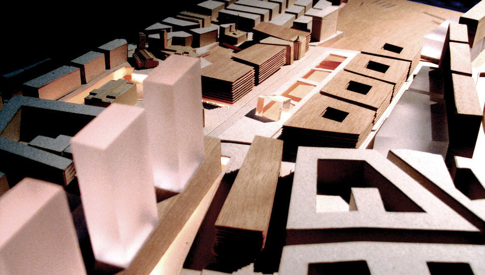
1. Urban environment legibility
Urban mobility: The urban mobility sine qua non condition concerns the purity and legibility of the public space environment in terms of geometry, use and hierarchy.
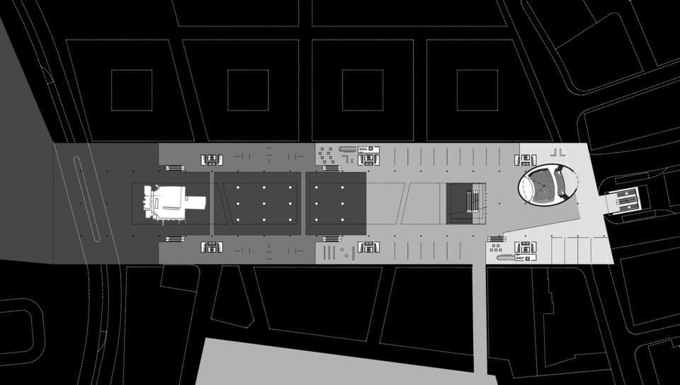
Public transportation: Legible coherence coincides with public transportation exclusive lanes. Such routes may offer a circular circuit that integrates small terminals and prevents buses from circulating inside the central area.
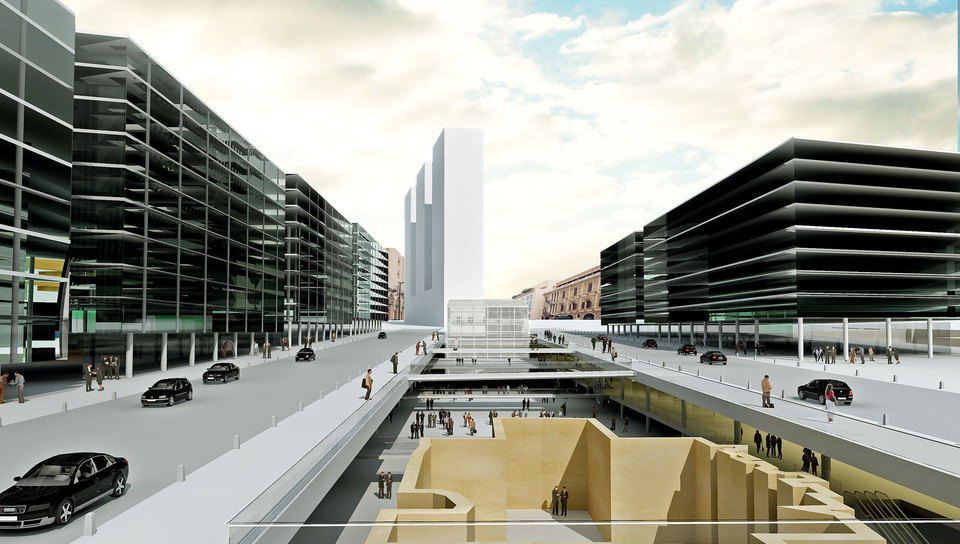
Parking lot: Located on the underground but thought as a duplication of the urban plan; projected with multiple access points in order to avoid traffic concentration as well as to proportionate quality and size to the urban scale.
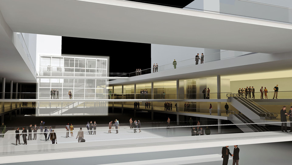
Pedestrian structure: Pedestrian-exclusive circulation areas designed from its particular logic, thus benefiting from the topography and configuring a structure detached from the traffic, connecting points of historical interest.
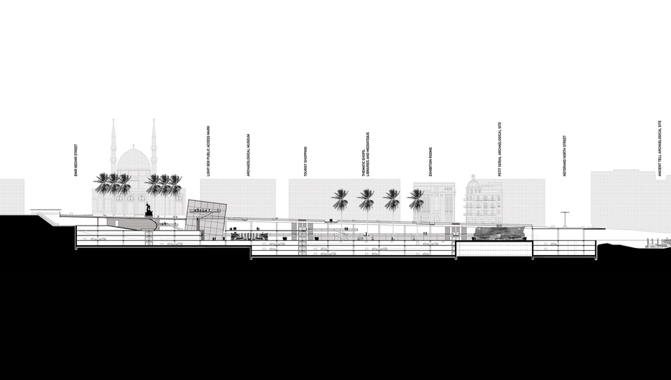
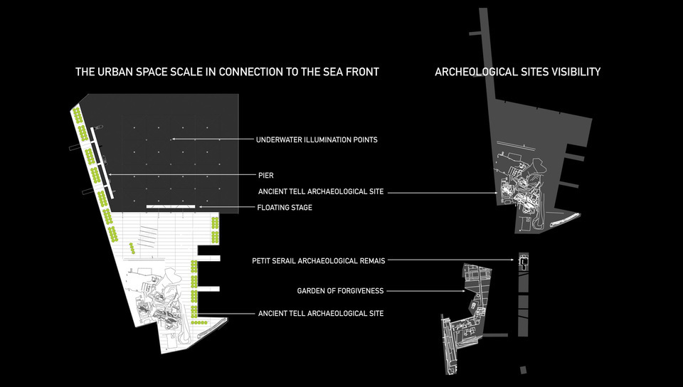
2. Archeological site visibility
Incorporating areas of historic value and inserting a visible structure into the city environment.
Regarding the city constitution, archeological areas must be granted as extremely distinguished marks and taken as inflection points within urban environment. Such areas will be dimensioned according to a spatial value appropriate to historical importance, which very frequently go beyond functional limits of the archeological site.
Green areas: Spatial complements meant for the public space demarcation and qualification, thus inserting hierarchy and scale into the urban context.
Illumination: Illumination in accordance with monumental hierarchy of points of interest, taking into account intensity and color in order to have a differentiated condition designed in relation to the city’s general illumination.
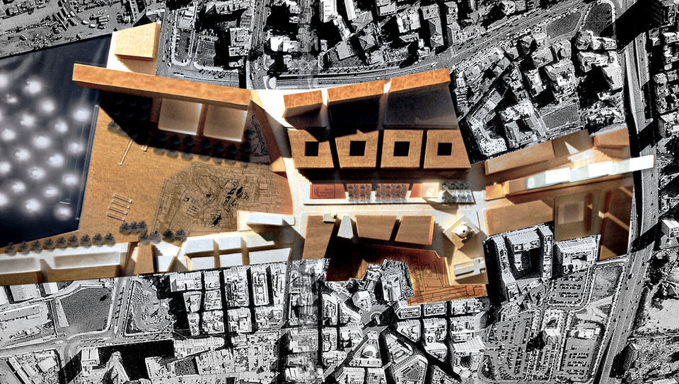
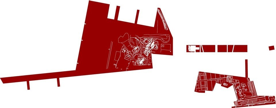
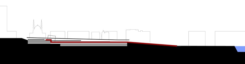
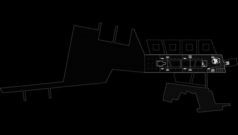
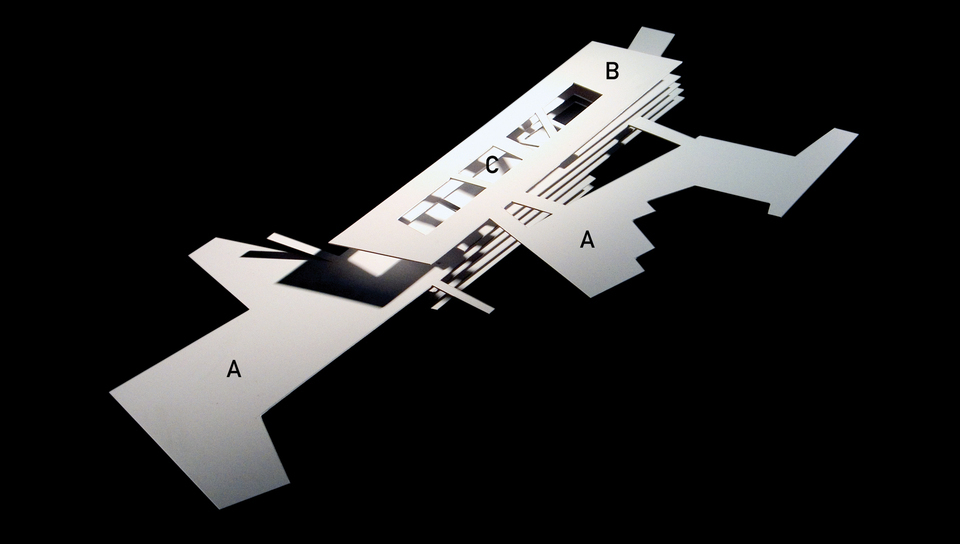
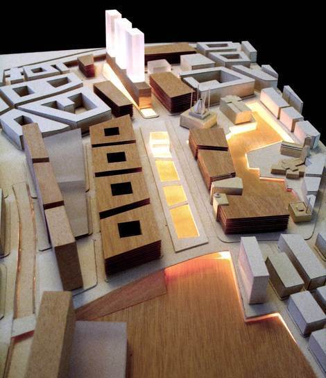
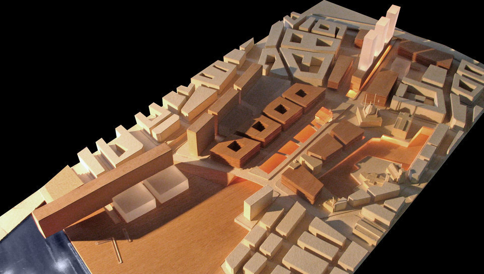
3. The archeological plan as a new determining topography
The development of an archeological plan projected according to +16 m quota defines a differentiated level meant to intercept the existing topography (which is referred to as contemporary plan) and naturally achieving, as a result, an unsuspected condition of great urban value.
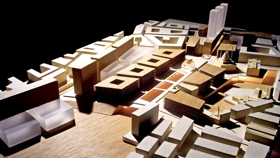
4. Urban space scale in connection with the sea
It has been proposed for the archeological area interface the expansion, reformulation and consolidation of its borders, having the historical space clearly qualified and defined.
This space will be continuously integrated with the waterfront through a big square, the apotheosis of the integrated urban events.
5. Increase in the urban ground potential
The correct reading of the local geography invites us to establish multiple-use plans, especially at Praça dos Mártires, which increases the urban ground potential as a great knot, therefore supporting its flows and variable activities, and transforming the square surroundings into a social area of extraordinary cultural environment and great value toward real estate development.
6. Spatial definition
The spatial reformulation of the area, inserted into the urban plan, does not take into consideration the topography (with an even inclination of 3%), thus compromising all the rulemaking efforts in order to “shape the city”. Hence, a proposal has been created according to the local specificities.
A better appropriate scale has been intended for the building on smaller streets, providing better sun exposure and ventilation conditions, always in accordance with the public space eligibility.
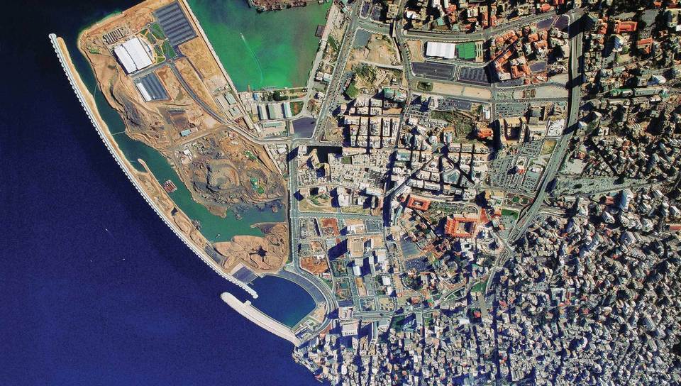
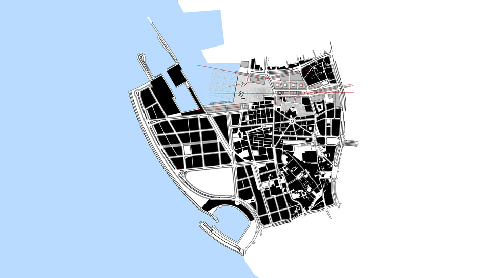
Location:
Beirut, Lebanon
Year:
2004
Client:
Solidere / Lebanon Government
Intervention area:
125.000 m²
Competition:
International Competition
Architecture and Urbanism:
VIGLIECCA&ASSOC
Hector Vigliecca, Luciene Quel, Ronald Werner Fiedler, Neli Shimizu, Ruben Otero, Lilian Hun, Ana Carolina Penna, Gabriel Farias, Bia Barquinero, Paulo de Arruda Serra, Luci Tomoko Maie