

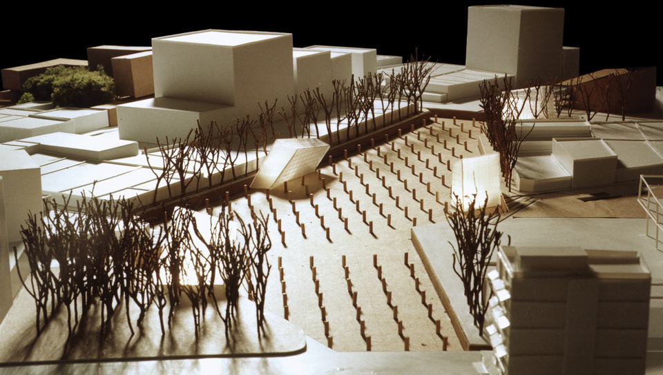
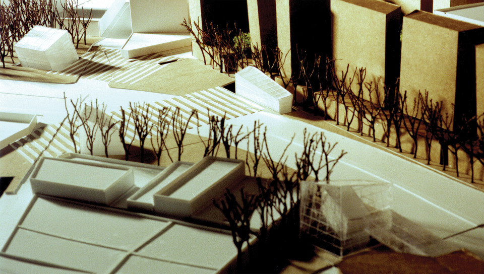
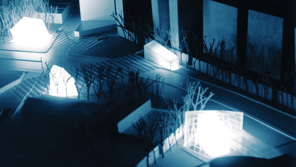
Batata Square

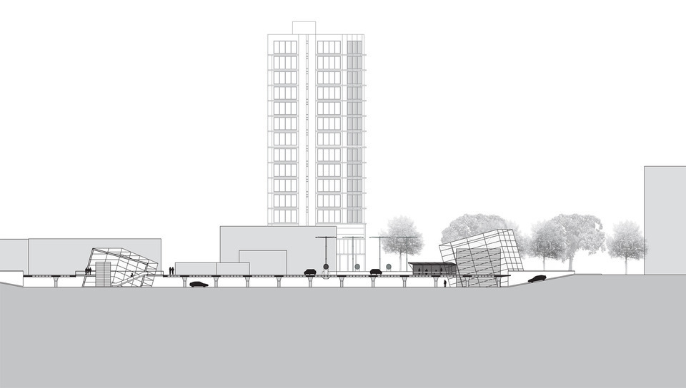
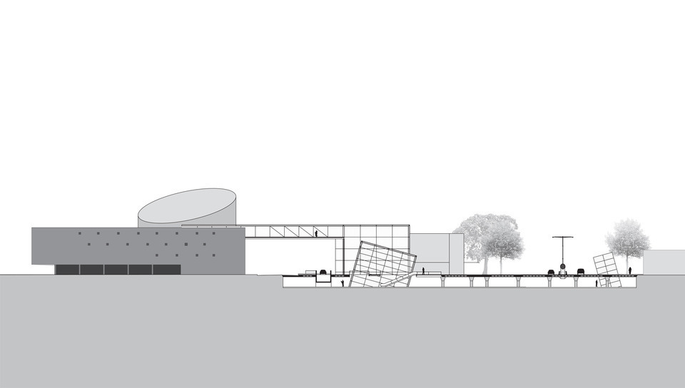
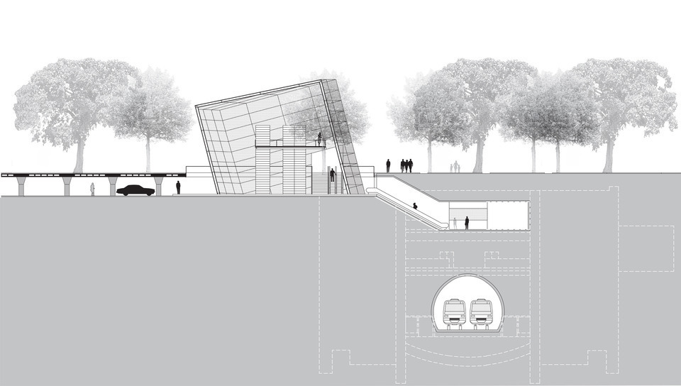
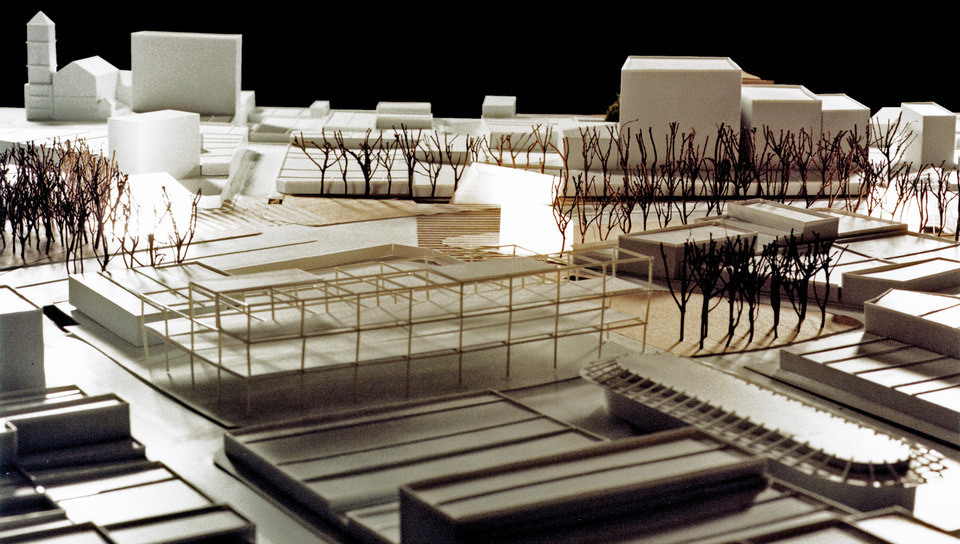
Promoted by the Urban Planning City Secretary, the Municipal Urban Planning Company and the Pinheiros Regional Administration, the Urban Redevelopment of Largo da Batata National Competition established a discussion on the public areas guidelines and the possible guidelines for private areas, considering street modifications, the implementation of a subway station (Faria Lima Station, Line 4) and the articulation of several public transportation modes.
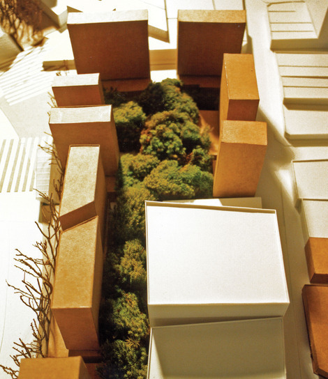
A “project area” was to be the focus of the proposals (the historical Largo da Batata), but a larger “intervention area” should be added to the project discussion, especially because structured projects would affect the neighborhood scale as well.
The value found in the memory and identity of the neighborhood has formed throughout history characteristics that cannot be ignored when seeking to make improvements for the city. The sensibility to local and unique qualities would avoid authoritarian decisions to transform an area under the excuse of a redemptive modernity that once implemented would end up quietly dispersing locals and their activities.
Here, the nostalgic stagnation of the city is not proposed as a value; on the contrary, a well thought transformation in envisioned, one that considers the participation and the interest of its inhabitants and users, those of which desire to remain there, but also desire urban improvements able to refrain urban degradation.
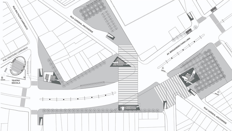
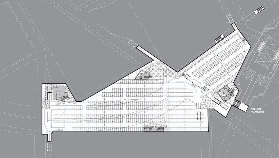
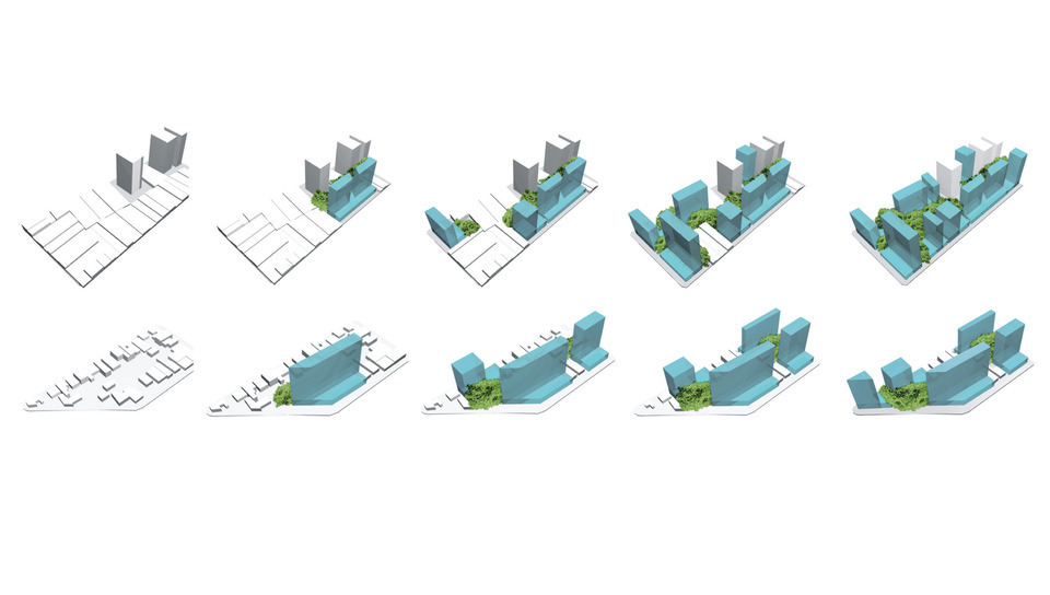
For the public area, many “direct interventions” were proposed; from lighting (specific for pedestrians and vehicles) to underground parking, that articulates with the subway and the ground level of the square (with six access points).
For the private area, direct and indirect interventions were considered. New housing units were destined to different income groups and a new legislation would be used as a guideline in order to maintain urban quality and unity during the occupation process.
Accessibility and Circulation
As an evidence of the mobility of the people, circulation emerges as a visible indicator of the environmental quality.
The Largo da Batata acts, inside of an urban system, as an important regional sub-center: Pinheiros attracts people from a large area that surpasses the Pinheiros river (which is an urban barrier), including Butantã and further along the Raposo Tavares Highway and Francisco Morato Avenue.
The circular-concentric road geometry of São Paulo results in fragile connection between local sub-centers.
In this proposal, improvements to the road system were suggested as well as connections between the Sumaré Avenue and Raposo Tavares Highway in an attempt to accentuate Pinheiro’s vocation as a sub-center and significantly value the Batata Square transformations.
Considerations on Managing the Urban Space
Public actions over private areas are engines for transformation. Without this initiative the public areas become dependent on unstable private investments in a way that any desired improvements related to the public realm, has an uncertain future.
The Activity in the Territory
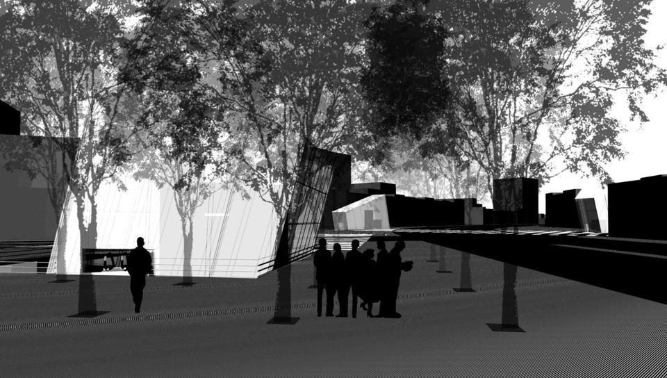
The Largo da Batata carries in its identity a metropolitan expression, the role of being a place for exchanges, transfer, circulation, social and functional mixtures of intense usage. It is from these urban qualities, which we consider precious, that our proposal was conceived.
Points of Exchange
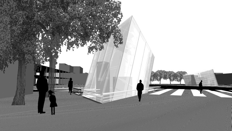
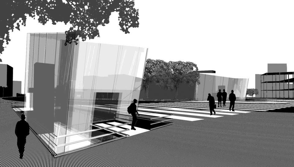
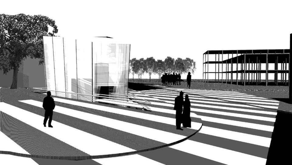
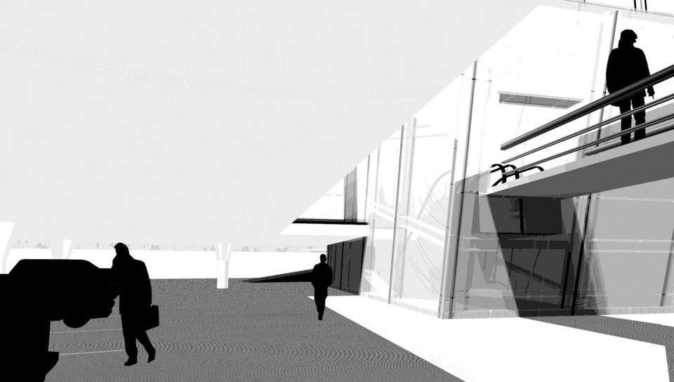
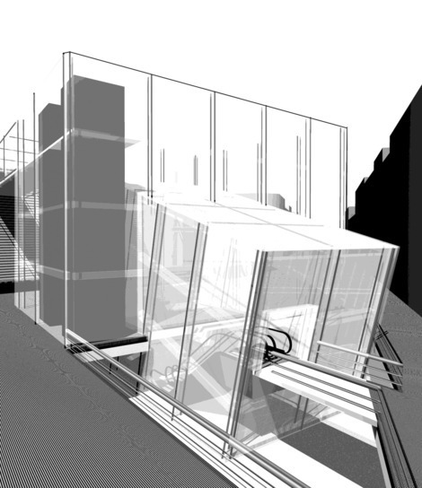
The pedestrian access points were meant to be “points of exchange”, being configured as lanterns that spotlight the lower level. They would be structures defined by controlled access points, bars, newspaper stands, subway waiting areas as well as a connection to the bus stops found on the street level.
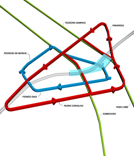
Ring and Reverse Ring Road System
The public transport and the main vehicles flows that cross the Square today (Marginal Ave – neighborhood) would have another alternative with the “ring” and “reverse ring” road system proposed, which would circle around the area’s core, no longer intercepting it.
Location:
São Paulo, SP
Year:
2002
Client:
Prefeitura Municipal de São Paulo / EMURB
Competition:
National Competition, Honorable Mention
Intervention area:
5,4 ha
Built area:
13.500 m²
Architecture and Urbanism:
VIGLIECCA&ASSOC
Hector Vigliecca, Luciene Quel, Ronald Werner Fiedler, Lílian Hun, Ana Carolina Penna
Administration:
Rosângela Maltese
Urban Legislation:
Sarah Feldman
Traffic and Transport:
Neuton Karasawa
Urban Afforestation:
Rodolfo Ricardo Geiser e Christina Ribeiro dos Santos
Model:
Mônica Brooke e Mario Echigo
Schedule:
Paulo Serra
Parking:
Aldo Villa
Real Estate Analysts:
José D’Avila Pompéia e Maria Augusta D.N.T. Steinhoff
Budget:
Ricardo Straub, Antonio Carlos Sant’Anna, Fabio Farias Galvão
Photographs:
Stepan Norair Chahinian