

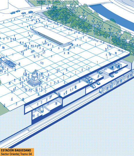
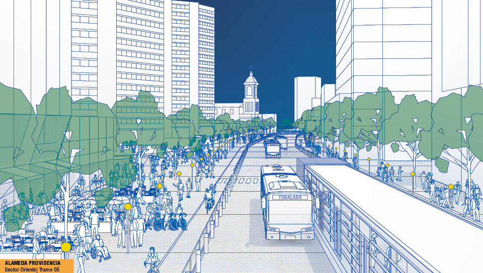
Providencia Boulevard

For our e-book about this project click here
Infrastructural Public Action as Urban Development Action
Urban development actions, the base for social and economic development of a city, assume a connection between actions for the public urban structure and the dynamics based on land usage.
This type of connection is fundamental especially when it comes to an urban development process within a centrality such as Alameda Axis, the heart of Santiago´s Metropolitan Area, where the intense dynamics that generates a great need for public transportation and public spaces is directly related to land usage.
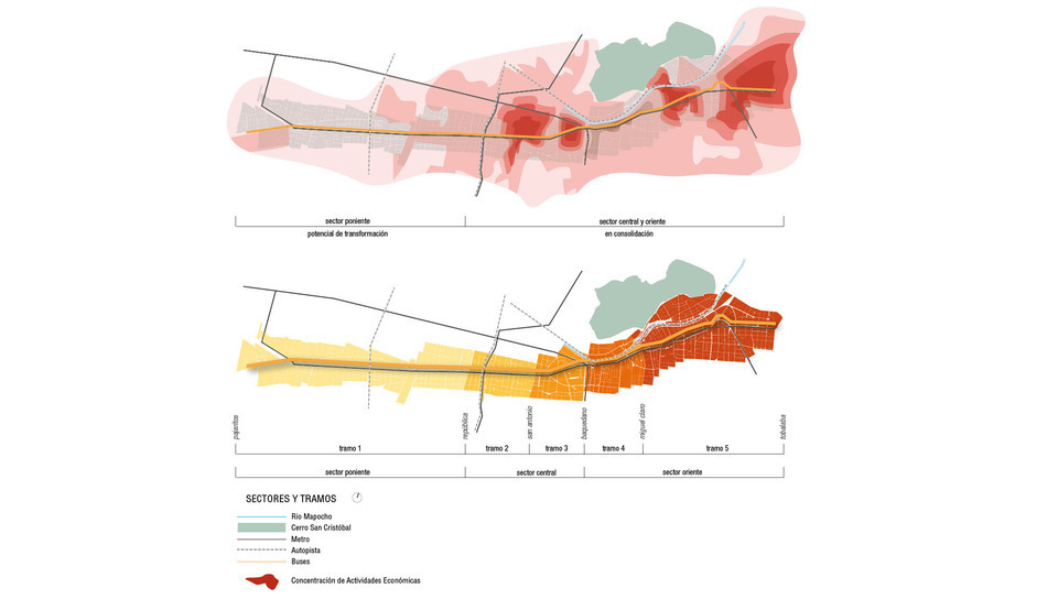
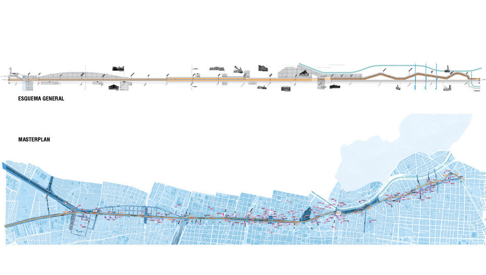
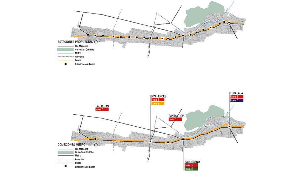
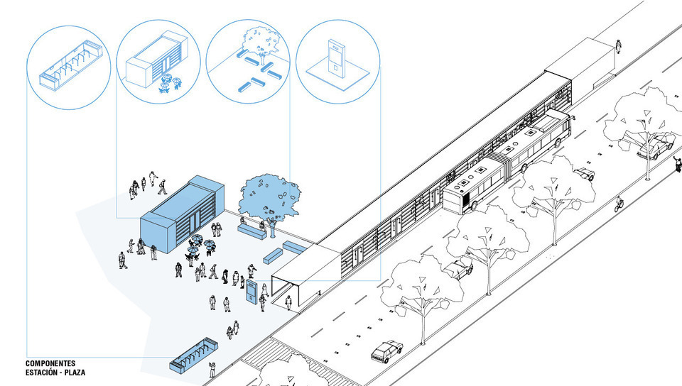
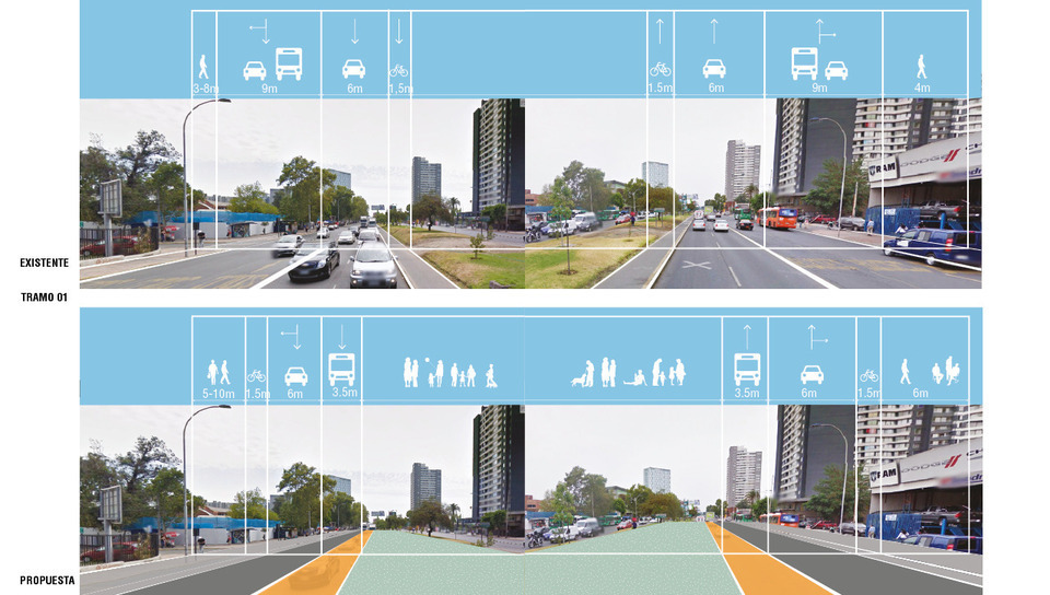
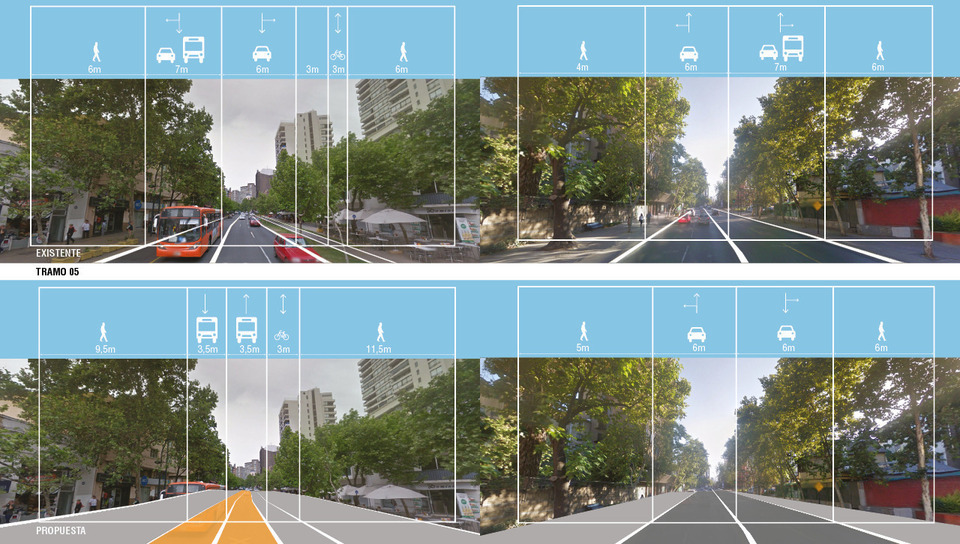
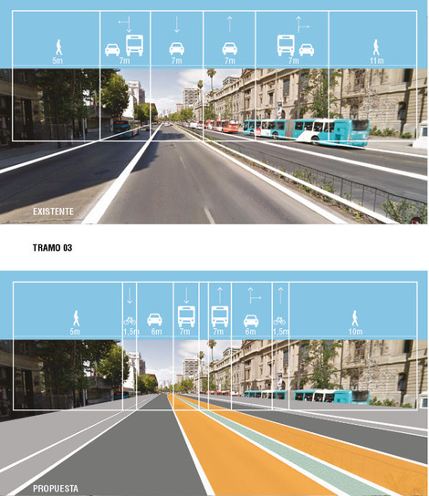
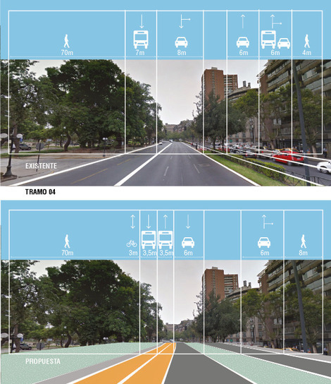
Therefore, infrastructural public action for Alameda Axis, including a new public transportation corridor and the improvement of several public spaces, must serve as a base for consolidation of existing uses and activities in Providencia and the Central Sectors, as well as a catalyst for new uses and activities towards Pajaritos. This area has great potential to become a new job centrality by taking advantage of its increasing population density, strategic location, regional services, leisure facilities and areas that are ready to host future transformation generators. And, in addition, a newly installed along with a soon to be installed public transportation infrastructure with the purpose of consolidating the metropolitan character of this centrality along its entire extension, from east to west.
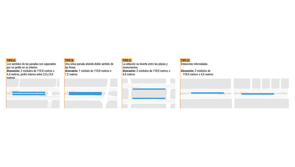
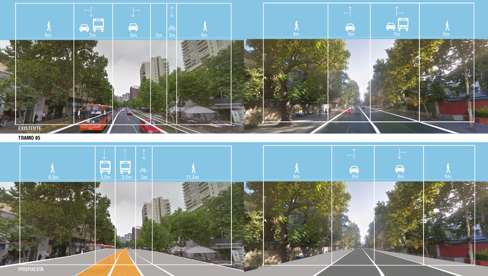
Criteria and Premises of actions for each sector
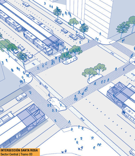
The process of establishing premises and criteria for actions directed to the public transportation circulation and public open spaces along the Metropolitan Centrality Alameda Axis considered three main actions:
a. UNDERSTANDING the physical structure, circulation flow associated to land usage and the future development potential of each sector and its specificities with the purpose of identifying specific needs and the type of actions in each sector.
b. PRIORITIZING the elements and the dynamics that must be consolidated or renewed in each sector, in proportion to the capacity and efficiency of the new public transportation system and, the possibility of improving open public areas.
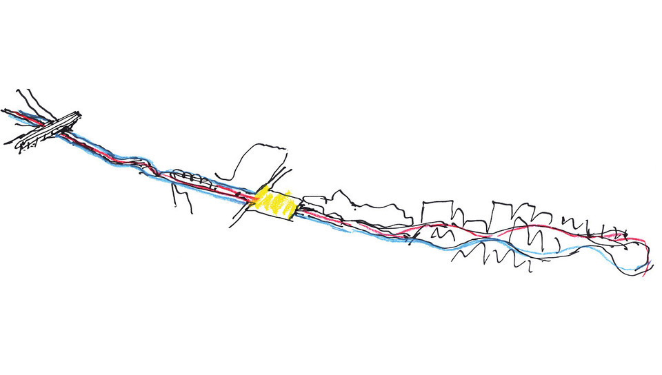
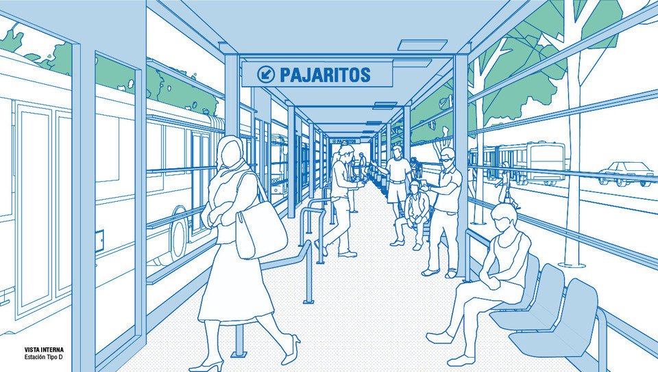
c. GIVING LEGIBILITY to public actions proposed along the entire central axis, from East to West, through an integrated circulation system including existing and future transportation modes, bike lanes, pedestrian walkways, plazas, public squares and parks, that together form a defining identity for Alameda Axis.
Location:
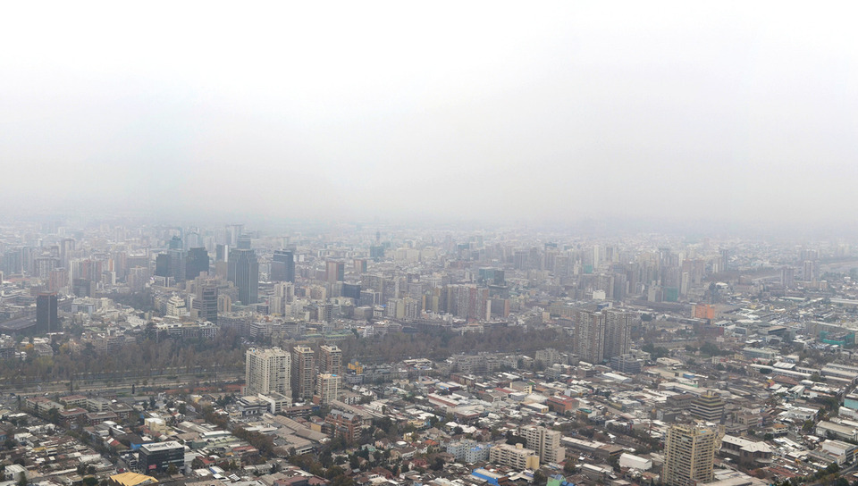
Santiago, Chile
Year:
2015
Client:
Gobierno Regional Metropolitano de Santiago
Intervention extention:
12 km
Competition:
Internacional Competition, Honorable Mention
Architecture and Urbanism:
VIGLIECCA&ASSOC
Héctor Vigliecca, Luciene Quel, Caroline Bertoldi, Ronald Werner Fiedler, Neli Shimizu, Carlos Collet, Carolina Passos, Cintia Castro, Flavia Tenan, Leandro Leão, Luiz Marino, Marcela Ferreira, Melissa Ramos, Pedro Ichimaru, Pía Gamboa, Paulo Serra, Luci Maie.
Transport Engineering:
TTC
Francisco Moreno Neto, Lucimar Maschio Cardone, Silvia Rosa Domingues, Felipe Costa Furuyama; Sônia Maria Alexandria de Araújo, Gustavo Alexandria Santana (apoio técnico)
3D model:
Bhakta Krpa